|
|
|
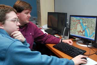
Michael Koehler (at left), GIS technician, and Michael Maloney, USNG coordinator and GIS technician, both with Delta State Center for Interdisciplinary Geospatial Information Technologies, view a sheet map of the national grid showing a three mile buffer around the U.S. Capitol.
|
In November, the Delta State University Center for Interdisciplinary Geospatial Information Technology was called upon by the federal government to help with then President-elect Barack Obama’s inauguration ceremonies.
The center teamed up with the United States Marine Corps, U.S. Geological Survey, Tele Atlas and TerraGo Technologies to create detailed mapping of the Washington D.C. area to aid responders in the event of a disaster.
“It started last year as a demonstration project for the Joint Task Force National Capital Region,” Talbot Brooks, director of the center, said.
The task force is a combination of military units and assets, government agencies and civilian units that convene under command of one agency during a regional crisis or high profile event requiring additional security.
“We convened under Department of Defense authority to provide homeland security and crisis response for 13 counties and Washington D.C.,” Brooks explained. “The fundamental problem the project was addressing was literally addressing lots of places that don’t have an address.
“One third of emergency response calls don’t occur at a street address … (so we needed) federal standards, easy to navigate by response groups that allow for the location of an individual without a street address.”
The staff at the center compiled a 754 page atlas using the United States National Grid that included a two kilometer buffer zone of the entire beltway area. The USNG is a federal standard for emergency response that allows directions to be given by coordinates rather than addresses.
“We made pages on the 1×24,000 scale with just street layers and other important details like state parks and important buildings such as the White House and Capitol,” Michael Maloney, USNG coordinator with the center, said.
Staffers took the step further and created 20, 1×6,000 scale maps for each 1×24,000 map to give added detail of the area for responders.
“It showed such details as the metro lines and all the interstate highways,” Maloney said. “It actually showed the location of subway entrances and exits.”
“It was used by the FBI and Secret Service to find possible sniping locations and used to find the best exit routes.”
Michael Koehler, student worker at the center, said the easiest way to comprehend how detailed the maps were was by comparing them to Google Earth.
“The 911 maps we make for counties and cities are nine times more detailed than Google’s maps,” he said. “These maps were four times larger than the 911 maps.”
“It’s a very big difference.”
Brooks explained that if the FBI was using binoculars and saw a suspicious person in a crowd that it would be difficult to tell agents to search a large crowd looking for something as prevalent as a baseball cap.
“If they look at the map and get coordinates, somebody can walk to that location easily,” he said. “It solves a problem when there is a massive public event.”
Working on maps that could very well play a critical role in the defense of a presidential inauguration humbled those students involved.
“It was a huge honor to be chosen to help make the maps for the inauguration,” Maloney said.
“It’s a good feeling,” Koehler said. “You feel really accomplished when your product is in the hands of the Secret Service, etc.”
Brooks added that this work shows how much the center has grown over the years and its importance not only in the region, but the country.
“We’re trying to do the Delta proud,” he said. “The leadership at Delta State … they recognize the center’s importance and have done so much for it.”
The 754 page atlas is now readily available for emergency responders in the D.C. area and the center is gearing up for future projects.
Word of their skills spread and shortly after the inauguration they were asked to create critical infrastructure maps for the Maryland State Police.
Information provided by The Bolivar Commercial -Michael Simmons


