The Delta State Geospatial Information Technologies Center (GIT) produced detailed United States National Grid maps of the areas most affected by Hurricane Harvey this week.
These maps will help emergency responders make the most of their resources to assist communities hit hardest by Harvey and the record rainfall and flooding that the hurricane generated.
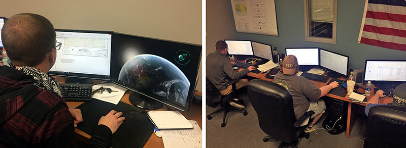
A small team of GIT students and other experts worked through the night of August 28 to produce the hundreds of maps needed by emergency responders on the ground around Houston. Most of these maps needed accurate and detailed annotation to show the location of critical infrastructure, provide points of reference to the responders on the ground, and the location of other features that allow the rescue work to go on in a safe, secure way.
The entire package of maps and information was produced and delivered in less than 24 hours.
“The GIT center is often asked to support natural disaster relief efforts. This is part of our continuing work with first responders such as fire and police departments,” said Talbot Brooks, GIT Center director. “Floods, earthquakes, epidemics and other disasters require immediate mapping support to help responders use their limited resources to best meet the most critical needs.”
Brooks said the mapping experience was very valuable to students in the GIT program.
“This mapping project gives us a chance to make a contribution to a real world problem,” said Tanner Overcash, senior GIT major and Marine reservist. “It’s very much like the missions the Marines are called on for, responding to hurricanes and typhoons all around the world. We’re excited to get to work on something that really matters. Hopefully, we helped make things better for the people who are suffering from Harvey.”
Brooks added it was another opportunity for Delta State students to experience the application of GIT to real world problems.
“We take a great deal of pride in producing map products like this database — something that makes a real difference in how we handle disasters like Hurricane Harvey,” he said. “Our students make a real and immediate difference when we get the opportunity to work on projects like this. The spirit of volunteerism is alive and well in the state of Mississippi. As volunteers, they were able to truly make a difference in the lives of their neighbors by bringing this technology to their search and rescue, damage assessment, and similar efforts. I’m honored to be associated with such a wonderful group of people.”
Learn more about opportunities at Delta State’s Center for Interdisciplinary Geospatial Information Technologies at https://www.deltastate.edu/college-of-arts-and-sciences/center-for-interdisciplinary-geospatial-information-technologies/.
The mission of the center is to provide geospatial services, accessible education and training, and institutional knowledge for geospatial information technologies to the widest possible audience, and particularly, the mid-Delta region.